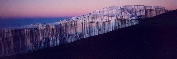
Mount
Kilimanjaro is the highest mountain in Africa and is the
tallest freestanding mountain on earth. It is crowned
with an everlasting snow-cap which can be seen from hundreds
of miles away making it a truly majestic and beautiful
mountain. Mount Kilimanjaro is within Kilimanjaro National
Park of Tanzania which is situated near the Equator. On
a clear day it is possible to observe the curvature of
the Earth and to see views as far as the plains of the
Masai Mara from the summit of Kilimanjaro.
There are very few other places in the world where you
will experience such diversity in climate and vegetation
during your ascent and descent and combined with interacting
with the locals, the magnificent views undertaking a climb
on Kilimanjaro really is an unforgettable experience,
one that will stay imprinted within you for many years.
History
and background
Kilimanjaro
is a dormant volcanic mountain and has three distinct
volcanic cones: Kibo the highest at 5,895 metres, Mawenzi
at 5,149 metres and Shira the shortest at 4,005 metres.
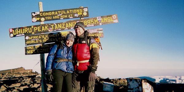
The highest summit "Uhuru Peak" is located on
Kibo's crater rim.
Although Mawenzi and Shira are extinct, Kibo is dormant
and could erupt again, with the last major eruption being
between 150,000 and 200,000 years ago. Several collapses
and landslides have occurred on the mountain, of which
the most famous one was on the western outer rim of the
main summit, Kibo. This area which was formed by lava
flow is now known as the "Western Breach".
Tanzania National Parks, and the United Nations Educational,
Scientific and Cultural Organisation list the height of
Uhuru Peak as 5,895 m (19,341 ft). That height is based
on a British Ordnance Survey in 1952, however since then
the height has been measured as 5,892 metres (19,331 ft)
in 1999, 5,891 metres (19,327 ft) in 2008, and 5,888 metres
(19,318 ft) in 2014.
One
of the 7 Summits
As
the highest mountain in Africa, Mount Kilimanjaro makes
up one of the Seven Summits (i.e. highest mountains on
each of the seven continents). Climbing the Seven Summits
is becoming quite popular with mountaineers and was first
achieved on April 30th, 1985 by Richard Bass. The other
mountains on the Seven Summits are listed below in height
order. Should you be interested you can also climb Elbrus
and Aconcagua with us.
Mount Everest - Asia - First ascent
1953 - 8,848 meters
Aconcagua - South America - First ascent 1897 -
6,961 meters
Denali - North America - First ascent
1913 - 6,194 meters
Mount Kilimanjaro - Africa - First
ascent 1889 - 5,895 meters
Mount Elbrus - Europe - First ascent
1874 - 5,642 meters
Mount Vinson - Antarctica - First
ascent 1966 - 4,892 meters
Mount Kosciuszko - Australia - First
ascent 1840 - 2,228 meters
First
Successful Summit
The
first person recorded to attempt to reach the summit Kilimanjaro
(Kibo) was probably Austrian-Hungarian Count Samuel Teleki
in 1887. Unfortunately his attempt was not successful
due to problems with his ears and was forced to turn back.
Another attempt was made by the American naturalist, Dr
Abbott, who had primarily come to investigate the fauna
and flora of the mountain slopes. Abbott was struck down
by illness fairly early on in the climb but his companion,
Otto Ehlers of the German East African Company, continued
and claimed to have reach 19,680ft (5904m). This was disputed
and dismissed by others, especially as the height he claimed
to have reached a summit level that is at least 8 metres
above the highest point on the mountain.
Although
they didn't summit themselves, both Teleki and Abbott,
played a part in the success of the eventual conqueror
of Kilimanjaro, by Dr Hans Meyer. Following his summit
attempt Teleki provided information about the ascent to
Meyer; and Abbott provided accommodation in Moshi for
Meyer and his party during their successful expedition
of 1889.
In total Meyer made four trips to Kilimanjaro, his first
two summit attempts were unsuccessful; however he finally
reached the summit on his third attempt, in 1889. Meyer
brought together all the things required to successfully
reach the summit, being a skillful and determined climber,
but also having enough food and drink along the route,
especially near the summit. He establishing camps at various
points along the route that he had chosen for his attempt,
including one at 3,894m (12,980ft; Abbott's camp); one,
Kibo camp, 'by a conspicuous rock' at 4,263m (14,210ft);
and a small camp located just below the glacier line at
4,578m (15,260ft). It was due to these intermediary camps
that Meyer was able to have a number of attempts to the
summit with porters bringing food to each of the camps
every few days food.
Meyer also had a considerable back-up party with him,
including his friend and climbing companion, Herr Ludwig
Purtscheller, as well as two local headmen, nine porters,
three other locals who would act as supervisors, one cook
and one guide were also supplied by the local chief, Mareale.
The team carried the equipment to each of the camps, whilst
also keeping the camp in order following Meyer's strict
code of discipline, which involved punishments of ten
or twenty lashes.
In
the late 1800s there was a lot more snow on Kilimanjaro
than there is today, and above 4500m Meyer would have
had to trek in snow for almost the whole day, proving
to be a lot more technical and challenging than the snow
free route used today by thousands of trekkers each year.
At one stage the whole of the mountain summit was covered
by an ace cap, estimated to be more than 100 metres deep.
Since 1912 Kilimanjaro has lost 82% of its ice cap, and
since 1962 it has lost 55% of its remaining glaciers as
these have been rapidly receding over the past century.
It is estimated that if the present rate of recession
continues the majority of the glaciers on Kilimanjaro
could vanish altogether.
Climate
and Vegetation
As
ascent on Kilimanjaro is like going from the Equator to
the Artic. The temperature drops 1c for every 200 meters
of height and it is this that has caused the natural formations
of the five very distinct vegetation and climatic zones.
These five zones are around 1000 meters in height per
zone and encircle the mountain so each day gives you a
different climate and different vegetation to hike through.
There's very few other places in the world where you will
experience such diversity making it a very unique place.
You certainly have to ensure that you have the appropriate
clothing to deal with all different weathers and extremes
of temperature both during the day and at night.
Zone 1: Lower slopes: This zone includes cultivated land,
grasslands and populated human settlements and is around
800 to 1600 meters in altitude and is very dry and warm.
Zone 2: Rain Forest: This zone is from around 1000 to
2800 meters and is predominately wet.
Zone 3: Heath/moorland: The heath and moorland are overlapping
zones and are also classed as Low Alpine zone as temperatures
can drop to below 0c but be warm during the day. Most
precipitation in this zone is from the fog and mist. The
zone is from 2800m to 4000metres.
Zone 4: High desert (Alpine desert) : This zone goes from
4000 meters to 5000 metres and receives very little rain,
intense daytime sun and cold night time temperatures varying
from freezing to 40c.
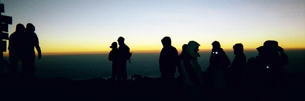
Zone 5: Summit zone (Artic zone) : This zone gives you
hot day time sun and freezing cold at night as characterised
by artic conditions with very little rain. The oxygen
is so thin in the zone of 5000 meters to 5900 meters that
you have to be so careful as to not burn from the suns
radiation.
Routes
on Kilimanjaro
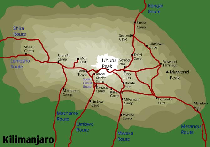
There
are seven main routes leading up the slopes of Kilimanjaro
to Uhuru Peak. These are the Shira Route, the Lemosho
Route, the Machame Route, the Umbwe Route, the Mweka Route,
the Marangu Route and the Rongai Route. At Icicle we offer
you the choice of either ascending using the Machame or
Rongai Routes as these are both so much more quieter than
the other routes and more importantly offer the greater
chance of summit success.
Routes
used by Icicle on Kilimanjaro...
We
offer ascents via the Machame or Rongai routes on the
mountain. We avoid
the 'normal' Marangu Route, as it gains height every single
day, not allowing your body any time to acclimatise. For
the descent the Mweka Route offers the quickest method
of losing height, which is an essential method of avoiding
potential altitude sickness issues that may affect people
after their summit bid. January and February are popular
months for climbing Kilimanjaro. July through to September
are the dry season and are "high" season, with
April to mid-June tending to be the rainy season. The
Icicle Kilimanjaro treks run from later January, February
and March, and also in September, months which usually
have the most favourable weather conditions.d
Machame (Whiskey) route
The standard Icicle "Kilimanjaro 5895m" trek
runs from Saturday to the following Sunday (9 days) and
uses the Machame Route for ascent, and the Mweke Route
for descent.This route is a lot quieter than the others
as its slighty harder but offers the best views. This
route gives you a greater acclimatisation potential in
that you ascend to around 4000m, then spend three days
traversing around the mountain at this altitude before
ascending to the final camp at 4600m. This means you are
very well acclimatized to move to the top camp just before
the summit day. Clearly this works as we have had a 95%
success rate on the mountain since 2005. The route rewards
climbers with tremendous views over the expansive Shira
Plateau, has an optional scramble up Lava Tower, a climb
up the Great Barranco Wall, and a traverse under Kilimanjaro's
Southern Icefield. The route also descends through some
amazing jungle scenery on the way to the park gate, and
it is highly likely that you will see Blue and Gibbon
monkeys swinging through the trees. At present there are
no huts on the Machame Route and therefore the only accommodation
option on the route is camping.
Rongai
(aka Loitokitok) Route
The Rongai route is the only easy route starting from
the North, and offers great views of the Kenyan savannahs.
The route runs from the north-east, and has no technical
parts along the route, so it is suitable for less experienced
climbers. It is also much drier than the other routes,
and relatively quiet due to most people using other routes
up the mountain. Descent from the summit is down the Marangu
route. This route is usually completed in 7 days, but
can be done in 6 days, and has some huts on its route,
but also requires some nights camping.
Other
routes on Kilimanjaro (only used for bespoke trips by
Icicle)
Marangu "Coca Cola" route
The Marangu Route, which is commonly known as the "Coca
Cola" route, is the most popular "tourist"
route to the summit of Kilimanjaro. The route gained its
alternative Coca Cola name more than a century ago when
locals supplemented their income by selling bottles of
Coke and other drinks to hikers who took shelter in sleeping
huts along the trail on their way up the mountain. Although
the Marangu Route is the easiest route to the summit of
Kilimanjaro, many climbers still fail to summit via this
route due to lack of proper acclimatisation, as many try
to reach the summit in as few days as possible.
Shira Route
The little-used Shira Route is a difficult route that
begins on the west side of the mountain. The first part
of the route is unusual as it offers the option of being
driven along the first part of the trail. Although this
is an attractive option to some hikers, it also results
in climbers missing out on hiking up the rain forest,
during which they would acclimatise slowly. Hiking on
this route usually starts at Shira Gate, and descent is
usually down Mweka to the south-east. Due to the trek
starting and finishing in different places transportation
is required at the bottom of the mountain. The Shira Route
has very low traffic compared to other routes, until the
point where it merges with the Machame Route. The Shira
Route can be completed in six days, however care needs
to be taken to factor in enough time for proper acclimatisation
due to the significant altitude gain on the first day
of the trek. In particular, additional care needs to be
taken for proper acclimatisation for those who opt to
be driven along the first part of the trail.
Lemosho Route
It is a relatively new route, created by the Kilimanjaro
Park Authority. The trek along the Lemosho Route begins
at Londorossi Gate which is located in the western base
of the mountain, and leads across the Shira Plateau before
circling along the southern circuit halfway around the
mountain. The approach to the summit is from the east,
and the descent follows the Mweka Trail. The Lemosho Route
usually takes eight days (seven nights), however it can
be done in as little as six days (with five nights on
the mountain).
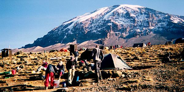
Camping
on Kilimanjaro
In
order to protect the environment and nature, camping in
most places of the National Park is prohibited; however
there are several designated camps on Kilimanjaro along
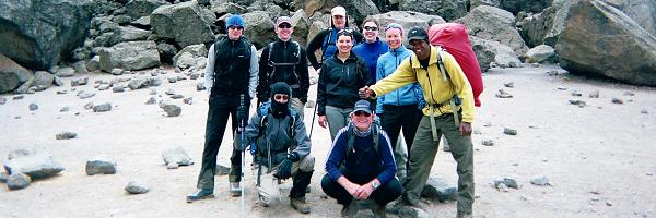
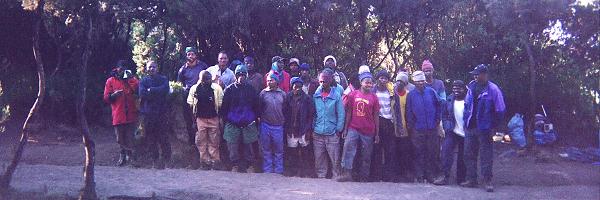
the six trekking routes. Most organized expeditions on
Kilimanjaro include the use of a local guide and up to
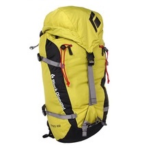
three porters for every two clients. This level of support
is necessary to carry all the equipment such as tents,
sleeping bags, as well as the mess and cook tents and
food that is required for the duration of the trek. Each
day camp will be established and set up by your support
crew, you will just be required to pack your main kitbag
each morning ready for your porter to carry.
Preparation
& Acclimatisation
Although
the summit of Kilimanjaro can be achieved by many walkers,
one of the main reasons for failure is due to lack of
proper acclimatisation, and people trying to rush the
route over a limited number of days which can be fatal.
Anybody can feel the effects of altitude so it is very
important and vital to follow the proven, recommended
golden rules to allow yourself to acclimatise safely and
properly. The main golden rules are to walk "pole
pole" which is Swahili for "slowly slowly"
which you will hear over and over from all your guides
and is even written on T.shirts as its such a vital and
iconic slogan which will determine success or failure.
The other golden rule is to "climb high, sleep low"
of which our itinerary has been formulated around to enable
you to ascend the recommended height per day, then descend
to spend the night which acclimatise you efficiently and
safely. Our experienced guides will give you plenty more
advice and guidance during your trek.
An ascent of Kilimanjaro should not be underestimated,
and you should arrive for this adventure in good physical
condition as the trek is arduous and the fitter you are
the more you will enjoy it. We highly recommend that you
read our training page (click here) for details on how
to prepare or call us to talk it through.
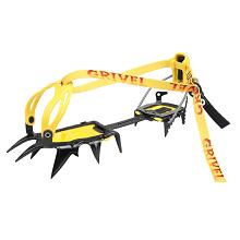
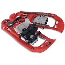
You should be efficient in moving safely over loose and
rocky terrain and on sometimes experience on snow using
crampons is required, so if you are not already please
consider addressing that by either taking part on our
Lake District or Scottish Courses, or going out yourself.
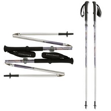
You will really benefit from using trekking poles on this
trek so again you can learn how to use them prior to going.
Summary
and postscript to the focus page
This
page is constantly updated as a result of changing techniques,
conditions, and latest news. Please don't use this page
alone as the research you undertake for an ascent, and
it does definitely not attempt to offer any of the instruction
of techniques which you will require. Details of many
other sources of information have been provided, which
you should consult before an ascent. Remember that to
climb Kilimanjaro is really a privilege, not a guarantee.
If you found this page of use, and have any other information
that others may find helpful, then please e-mail us. We
will post any useful extra information on the page, and
you will be cited. It is this sharing of knowledge that
makes the climbing community so close, and this extra
knowledge will increase your chances of reaching the summit.
We
are in the process of developing these mountain
focus pages for many of the key peaks that we offer
trips too, in order to help people prepare better
for their trips.
This
page has largely been written by Jill
from our Windermere
HQ, and it's here that most people
have their first contact with us, in person or on
the phone.
We
are always editing these pages, so if you have any feedback
about information we should add to the page, please let
us know. We feel it's important that all our staff are
experts on the mountains we offer trips to, so we are
all involved in developing these focus pages.
A
key part of choosing a company is being able to come and
talk about your plans with an experienced course advisor
face to face. In an increasingly virtual world, we know
our clients value speaking to real people, getting open
and honest advice. The vast majority of our clients are
British, and our office and outdoor store is based in
Windermere in the English Lake District.
Get
in contact to arrange a meeting, and come in for a coffee
to discuss your course in person with a trip
advisor.